
Vista Trail
Rouge National Urban Park
Please consider taking public transit as parking is extremely limited, particularly on the weekends.
![]()
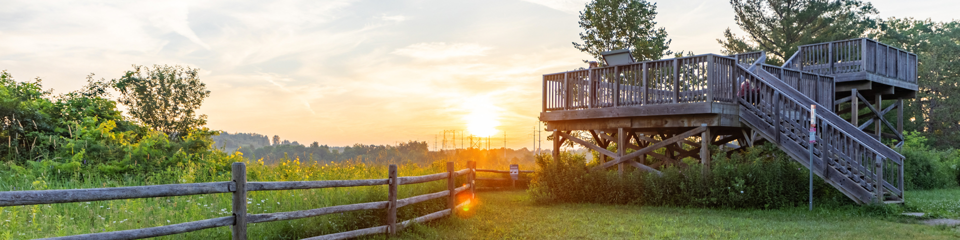
The Vista Trail’s two-level viewing platform is one of the best places to view Toronto’s autumn colours and spectacular valley views.
| Location |
North trailhead South trailhead |
| Difficulty | Moderate  |
| Distance | 1.5 km (one way) |
| Time | 1 hour |
| Washrooms | Portable toilets are available seasonally |
| Parking | Parking is available at Zoo Road Day Use Area from 7:30 am to 9 pm. Street parking is not permitted, and illegally parked vehicles will be ticketed and/or towed. |
Trail Features
- Fall colours and viewing platform – A two-level viewing deck built in collaboration with Ontario Power Generation, near the Zoo Road Day Use Area, is one of the best places to see fall colours in Toronto. The lookout provides spectacular views of the Little Rouge Creek and Rouge River valleys throughout the year.
- Beare Hill – From the viewing platform you can see Beare Hill to the north. Once a landfill (it was decommissioned in 1983), today the hill is one of the highest points of land in the City of Toronto.
- Ridge walks and forest diversity – Tree diversity and microclimates are a prominent feature along the trail’s forest ridge just past the viewing deck and hydro corridor. Here, maple and oak trees dot the warm southern slopes, while shady hemlock groves cover the cool northern aspects.
- Date modified :